The Ultimate Camping Checklist for a UK Summer Weekend
A practical packing list for a UK summer camping weekend, covering shelter, sleep, cooking, clothing and...

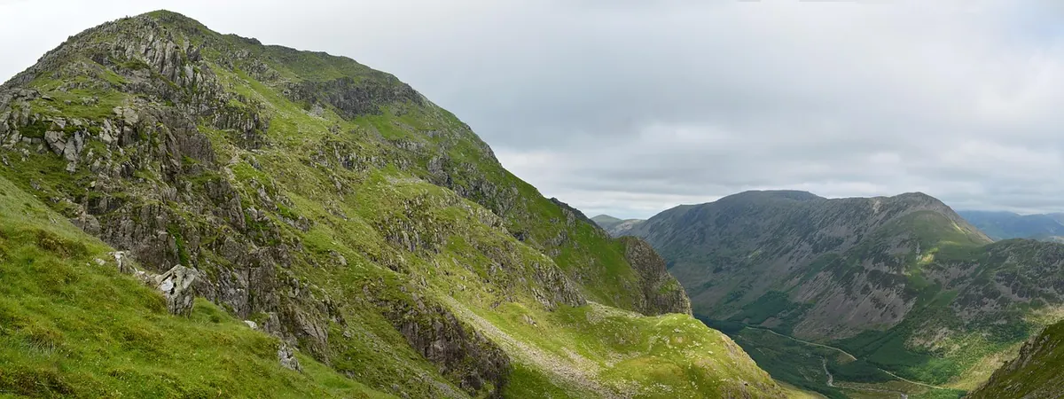
The Lake District has a reputation as a place you need a car to enjoy. Look at a bus map instead and a different picture appears: a railway that runs to within a few minutes of the fells, valley buses linking the main villages through the summer, and lake boats that set walkers down at jetties where the only alternative is a long road trudge. Going car-free removes the two worst parts of a day out — hunting for a parking space at ten in the morning, and driving home when your legs have had enough.
It also changes the shape of the day, mostly for the better. You set off earlier, because the 08:12 won't wait for you. You finish at a fixed hour, which stops a pleasant afternoon from quietly turning into a nine-hour epic. And on the way home you sleep against a train window instead of gripping the wheel on the A591. The price of all that is dependence on timetables, so the planning has to happen at the kitchen table rather than in a lay-by.
There are really only three questions to answer: how do I reach the start, how do I get away from the finish, and what do I do if the weather or the legs give out? Get those right and the rest is just walking.
Almost every car-free day in the Lakes starts at one of a handful of stations. On the West Coast Main Line, Oxenholme is the classic gateway: a shuttle train runs from there to Windermere through Kendal, Burneside and Staveley, and from Windermere station it is a short walk or a couple of stops by bus down to Bowness and the water. Penrith is the better choice for the north-east, with buses heading out to Pooley Bridge, Glenridding and the Ullswater shore. Carlisle opens up the northern fells and the Cumbrian Coast line. From the south, Ulverston and Barrow-in-Furness get you towards Coniston and the quieter western valleys.
Two smaller stops are worth knowing about. Ravenglass, on the coast line, sits at the mouth of the Eskdale valley and is the terminus of the Ravenglass and Eskdale Railway, the little narrow-gauge line that carries walkers up to Dalegarth, a short walk from Boot and the paths onto Scafell. Foxfield, a few minutes further down the same line, is the nearest station to Broughton-in-Furness and the Duddon Valley — and the ride along that coast, with the fells on one side and the offshore wind farm on the other, is worth the fare on its own.
Book ahead if you are travelling any distance. Walk-up fares into Oxenholme or Penrith are brutal, while an advance ticket can cost less than a day's parking plus fuel.
The valley network is better than its reputation, but it is seasonal and it is not generous. The workhorses are the long-distance routes — the 555 up the spine from Lancaster through Kendal, Windermere, Ambleside and on to Keswick, and the 599 between Bowness, Ambleside and Grasmere — supported by a web of shorter services feeding Borrowdale, Buttermere, Great Langdale, Coniston and Ullswater.
A day ticket covering the local bus network usually pays for itself after two or three journeys and removes the faff of finding the right change. Buy it on the first bus.
Lakes are the secret weapon of car-free walking, because they let you walk a linear route without a second car or a long return leg. Windermere has piers at Bowness and Waterhead plus the ferry across to Ferry House at Far Sawrey. Ullswater's steamers call at Pooley Bridge, Howtown, Aira Force and Glenridding. Derwentwater's launches stop at Hawes End, High Brandelhow and Lodore, and Coniston and Buttermere run smaller operations of their own.
The classic is Catbells: launch from Keswick to Hawes End, up the ridge, down to Grange or Portinscale, and back into Keswick on foot. No car shuttle, no retracing your steps, and a view of the whole northern lake for most of the climb.
This is the single habit that makes car-free days work. Don't plan the walk and then go looking for a bus home; find the last sensible departure and work backwards from it.
Rule of thumb: if the last bus leaves at 18:00, be at the stop for 17:30. A missed bus is a taxi fare; two missed buses is a night in a bed and breakfast you didn't budget for.
Train to Oxenholme, change onto the Windermere shuttle, walk the few minutes to the bus stop, and ride north to Keswick. From the bus station it is a short stroll to the Keswick launch. Sail to Hawes End, climb Catbells, drop down to Grange and follow the shore path back through Portinscale to Keswick. That leaves time for a late lunch in town before an afternoon bus south and an evening main-line train home. Total walking: three to four hours. Total driving: none.
Car-free days rarely fail for dramatic reasons. They fail over a dead phone battery, a village shop that shut at four, or a timetable that only exists online.
Buses run late, boats are cancelled in high wind, and legs give out sooner than promised. None of it is a disaster if you have options. Taxis operate from Keswick, Ambleside, Windermere and Penrith, and a hop between neighbouring valleys is often surprisingly reasonable when split between two or three people. In the worst case, most Lakeland villages have somewhere to sleep, and the next morning's bus will still be there.
What you notice after a few car-free days is how much of the day you get back. No circling a full car park at Ambleside, no queue out of Grasmere at five o'clock, no white-knuckle drive home on tired legs. Just a walk, a boat, a bus and a train — and the fells seen properly, at the speed they deserve.
Photo: BuyCustomThings / Pixabay
A practical packing list for a UK summer camping weekend, covering shelter, sleep, cooking, clothing and...
A practical beginner's guide to reading Ordnance Survey maps and using a baseplate compass, covering...
A season-by-season guide to wild swimming in the Lake District, covering realistic water temperatures, the...